


Lü - Costainas - S-Charljoch - Müstair

bffcuc
User
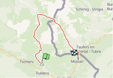

Length
23 km

Max alt
2300 m

Uphill gradient
682 m
Km-Effort
35 km

Min alt
1243 m

Downhill gradient
1368 m
Boucle
No
Creation date :
2014-12-11 00:00:00.0
Updated on :
2014-12-11 00:00:00.0
7h19
Difficulty : Unknown

FREE GPS app for hiking
 SityTrail
IGN / Geographical institutes
SityTrail Plus
The world is yours!
About
Trail Other activity of 23 km to be discovered at Grisons, Region Engiadina Bassa/Val Müstair, Val Müstair. This trail is proposed by bffcuc.
Positioning
Country:
Switzerland
Region :
Grisons
Department/Province :
Region Engiadina Bassa/Val Müstair
Municipality :
Val Müstair
Location:
Unknown
Start:(Dec)
Start:(UTM)
604790 ; 5164255 (32T) N.
Comments